ESMap is a service that tracks police, EMS, and fire department activity through their publicly accessible computer-aided-dispatch (WebCAD) logs. All of the collected information is plotted onto Google Maps to make it easy to find out what is going on in or around a certain area. Data is available in near-real-time. The service is currently only available in Orange County, Florida.
The service can be found here (link).
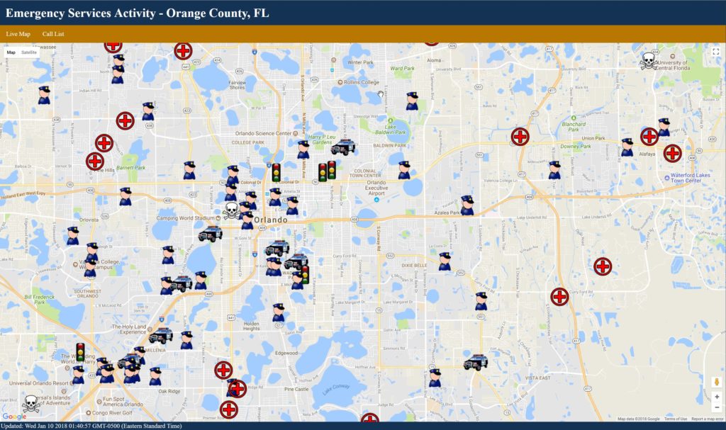
The source code for ESMap can be found on GitHub.
Some important things to keep in mind when using the service:
- All of the information comes from dispatch logs, which are based on initial reports from those on the scene. Many incidents may be described in vague terms (General disturbance, 911 emergency, suspicious incident).
- The information collected is only what the department has decided to release, meaning it may be subject to censorship (which may not be malicious; it can be done for officer safety, tactical considerations, patient privacy, or other reasons).
- Location plotting relies on Google’s Geocoding Service and as such may not always be accurate.
- Some municipalities, specifically those covered by smaller departments, do not make their CAD information accessible or do not have real-time reporting or do not give precise locations. There is nothing that can be done about this aside from contacting the relevant agency.